GEOSCOPE SOLUTIONS LLP
Geological and Geophysical Services
Looking for trusted Geological & Geophysical Services in Pan India? At Geoscope Solutions LLP, we provide precise, data-driven solutions that help geotech companies, government bodies, and private organizations make confident decisions.
From initial surveys to final reports, our team ensures accuracy, speed, and reliability. Whether your project involves drilling, tunnelling, infrastructure, or environmental planning, we deliver insights that reduce risks and improve outcomes.
Get in touch today and let’s discuss your project requirements.
Who We Are
At Geoscope Solutions LLP, based in Kurukshetra, Haryana, we specialize in delivering high-quality geological and geophysical consultancy services across India. Our approach combines advanced technology, field expertise, and industry knowledge to deliver practical solutions.
Clients choose us because we understand ground realities. We don’t just provide data—we provide clarity. Our services help reduce uncertainty in projects involving soil investigation, groundwater studies, infrastructure development, and more.
With a strong focus on accuracy, timely delivery, and transparent communication, we support projects of all scales across multiple industries.
Happy Customers
Why Choose Our Geoscope Solutions Services
Trusted Expertise
Our team has hands-on experience in handling complex geological and geophysical projects across diverse terrains in India.
Accurate and Reliable
High quality data collection and rigorous analysis to ensure precise and dependable results.
Advanced Technology
We use modern equipment and proven methodologies to ensure precise and reliable results.
Industry Expertise
We understand the specific needs of geotech companies, drilling contractors, and government projects.
Timely Execution
We value your deadlines. Our team ensures that every project is completed within the committed timeframe.
Client - Focused Approach
We listen, analyze, and deliver solutions tailored to your project needs.
Our Experts

Dr Rajesh Ranga
Field expertization (Geology) Sedimentology, Paleochannel analysis, Mapping, Active Tectonics, Mining Geology. Geology and Geophysical Field Survey.

Dr. Yoginder Singh
Field expertization (Geology) Paleochannel analysis, Mapping, Active Tectonics, Land Slide Hazards and Assesment, Geology and Geophysical Field Survey.
Vishal Khoure
Field expertization (Geophysics) Geophysical Surveys like ERT, GPR and VES
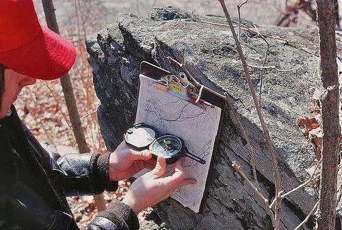
Geological Mapping
At Geoscope Solutions LLP, we offer professional geological mapping services to accurately assess surface and subsurface conditions.
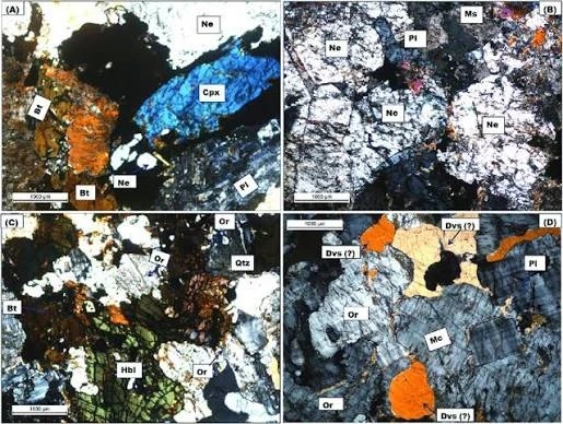
Thin Section Preparation
At Geoscope Solutions LLP, we provide precise and high-quality thin section preparation of rock samples to support detailed petrographic analysis.
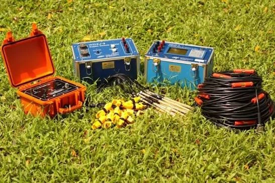
Electrical Resistivity Tomography (ERT)
At Geoscope Solutions LLP, we provide advanced Electrical Resistivity Tomography (ERT) services to investigate subsurface conditions with high accuracy.
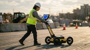
Ground Penetrating Radar (GPR)
At Geoscope Solutions LLP, we offer advanced Ground Penetrating Radar (GPR) services for non-destructive subsurface investigation.

Soil Testing
At Geoscope Solutions LLP, we provide comprehensive soil testing services to evaluate the physical and engineering properties of soil for safe and reliable construction.
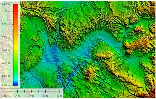
Remote Sensing & GIS
At Geoscope Solutions LLP, we provide advanced Remote Sensing and GIS services to analyze, manage, and visualize spatial data with precision.
Industry Serve
Frequently Asked Questions
What services does Geoscope Solutions LLP provide?
We provide geological investigations and surveys to understand subsurface geological conditions, rock and soil characteristics, lithology, structural features, and other site-specific geological parameters required for engineering, exploration, and environmental projects.
Do you provide drilling and borehole investigation services?
Yes. We provide drilling and borehole investigation services for geological, geotechnical, groundwater, mineral exploration, and other subsurface investigations, depending on project requirements.
Which geophysical techniques do you use?
The technique is selected according to the project objective and site conditions. Depending on the investigation, suitable methods may include Electrical Resistivity Tomography (ERT), Vertical Electrical Sounding (VES), seismic methods, magnetic surveys, electromagnetic methods, and other appropriate geophysical techniques. conditions, identify geological structures, and investigate groundwater, cavities, fractures, and other subsurface features.
What information do you need before starting a survey?
Typically, we need information such as the project location, site coordinates, area of investigation, project objective, existing geological information, proposed development, required investigation depth, and any available previous investigation reports. The exact requirements depend on the project.
How long does a geological or geophysical survey take?
The duration depends on the size of the site, survey technique, investigation depth, accessibility, terrain, number of locations, drilling requirements, and project objectives. A project-specific schedule can be provided after reviewing the scope.
Do you provide a detailed technical report after the investigation?
Yes. Depending on the scope of work, deliverables can include field observations, geological and geophysical data, maps, profiles/sections, interpreted results, borehole information, findings, conclusions, and project-specific recommendations.