Introduction
Ground Penetrating Radar (GPR) is one of the most advanced and non-destructive geophysical techniques used to investigate subsurface conditions. It helps detect underground objects, utilities, voids, and structural changes without excavation.
At GEOSCOPE SOLUTIONS LLP, we provide accurate and reliable GPR survey services using modern equipment to deliver precise subsurface insights for construction, engineering, and infrastructure projects.
What is GPR Survey?
GPR (Ground Penetrating Radar) survey is a geophysical method that uses high-frequency electromagnetic waves to scan the ground and detect subsurface features.
It helps in identifying:
- Underground utilities (pipes, cables)
- Voids and cavities
- Concrete structures and reinforcement
- Soil layers and subsurface anomalies
Why is GPR Survey Important?
GPR surveys are essential for safe and efficient project execution.
Problems without GPR survey:
- Accidental damage to underground utilities
- Unsafe excavation
- Project delays and financial loss
- Lack of subsurface information
Benefits of GPR survey:
- Non-destructive testing
- Accurate underground detection
- Improved safety
- Cost and time savings
Step-by-Step GPR Survey Method
A systematic approach is followed to ensure accurate results:
1. Site Inspection and Planning
- Understand project requirements
- Identify survey area
- Check site conditions and accessibility
- Select appropriate GPR equipment and frequency
2. Grid Layout and Marking
- Define survey grid on the ground
- Mark lines for systematic scanning
- Ensure proper spacing for accurate coverage
3. Equipment Setup
- Calibrate GPR system
- Select antenna frequency based on depth requirement
- Ensure proper battery and system functionality
4. Data Collection (Field Survey)
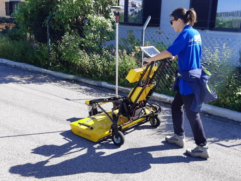
- Move GPR antenna over the ground surface
- Collect continuous subsurface data
- Maintain consistent speed and alignment
- Record data along all grid lines
5. Data Processing and Analysis
- Transfer data to software
- Filter and process signals
- Interpret radargrams (subsurface images)
- Identify anomalies and underground features
6. Interpretation and Reporting
- Analyze detected objects and structures
- Prepare detailed survey report
- Mark exact locations on site if required
- Provide recommendations
Applications of GPR Survey
GPR is widely used in various industries:
- Construction and infrastructure projects
- Utility detection (pipes, cables)
- Road and pavement analysis
- Bridge and concrete inspection
- Archaeological investigations
- Environmental and groundwater studies
Common Mistakes to Avoid
Avoiding these mistakes ensures better results:
- Using incorrect antenna frequency
- Poor grid planning
- Inconsistent scanning speed
- Misinterpretation of data
- Lack of skilled professionals
Why Choose GEOSCOPE SOLUTIONS LLP?
We provide professional and accurate GPR survey services.
- Experienced and trained experts
- Advanced GPR equipment
- Accurate data interpretation
- Reliable and fast reporting
- Cost-effective solutions
Contact Us Today
Need a GPR survey for your project?
Contact GEOSCOPE SOLUTIONS LLP for expert services.
📱 Call / WhatsApp: 9991624963, 9896441008, 7988670701